







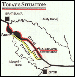
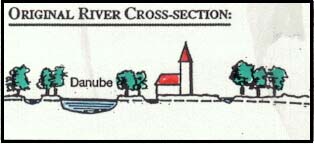
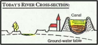
World Wide Fund for Nature (WWF) — maps and photos illustrating the diversion of the Danube at Gabčíkovo, before and after.
Large Scale Overview

 |
 |
 |
 |
|
|
See also: Recommendations by WWF and Independent Scientists
Contact
Addresses of the Editors:
|
Dipl. Geogr. Alexander Zinke WWF Austria P.O. Box 1 A-1162 Vienna Phone: 43-1/409 16 41 Fax: 43-1/409 16 41-29 |
Dr. Emil Dister WWF Institute for Floodplains Ecology Josefstr. 1 D-76437 Rastatt Phone: 49-7222/32 065 Fax: 49-7222/30 189 |
Copies are available at:
|
WWF European Office 608, Chaussée de Waterloo B-1060 Brussels, Belgium Tel.: 32-2/347 30 30, 347 36 12 (direct) Fax: 32-2/344 05 11 |
WWF Austria P.O.B. 1 A-1162 Vienna, Austria Tel.: 43-1/409 16 41 Fax: 43-1/409 16 41-29 |
 Mondák
 Vicc
 Költő / Író
 Népdal
